Watershed Index Online (WSIO)
|
Statewide Screening Tools Download 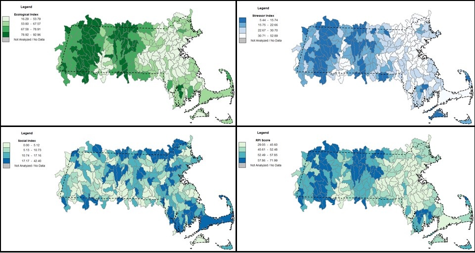
Ecological, Stressor, Social, and Integrated (RPI) Index Maps from an RPS Statewide Tool. For users who cannot use the WSIO tool because they lack ESRI license and Excel version requirements, the following tools are available. These tools can perform nearly all of the functions of the WSIO tool offline, with a few exceptions. One, the user does not define the project area because the tools below are pre-set to fully cover each state. Two, these statewide tools use a simple mapping function within Excel to display the state’s HUC12 watersheds, and do not link to ESRI Maps Online. Three, each of these tools is pre-loaded with data on over 200 indicators from the WSIO data library, so user selection of online indicator data is not a necessary step; however, additional indicators from WSIO or elsewhere can still be added to the tool’s data table by the user offline. Users may download pre-made statewide Recovery Potential Screening (RPS) Tools for each of the lower 48 states below. These tools will function using Excel 2007 or later version and require no ESRI license. Note: Download tool and open offline in Excel, not in Excel Online. If your file does not function properly when first opened, close it and open a second time. It will be fully functional from then on. Select Statewide Screening Tool: |